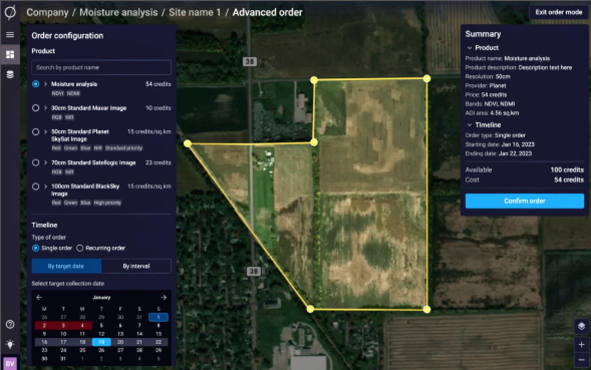
Traditionally, the defense and intelligence community (DOD/IC) has placed the commercial industry on a ‘technology pedestal.’

However, if imitation is the sincerest form of flattery, the DOD/IC should be increasingly flattered at the rapid adoption of GEOINT (GEOspatial INTelligence) best practices and techniques, such as TCPED (Tasking, Collection, Processing, Exploitation, and Dissemination), by private industry as an effective means for managing information derived from space.
Intelligence groups have long used the TCPED model to turn raw satellite data into actionable intelligence. However, did you know that commercial enterprises are now adopting this model to harnes the power of satellite data and geospatial intelligence for their own planning purposes?
What’s driving this trend?
The exponentially increasing availability of, and access to, high- quality satellite data is certainly a major factor. Thanks to the development of small, low-cost satellites, companies can now collect their own satellite imagery with ease.
If that’s not enough, the commercialization of space has resulted in an explosion of commercial providers of satellite imagery and other geospatial services offering a wide range of information products and services.
Navigating the volume and variety of information available from space efficiently and effectively is a daunting task for most commercial organizations.
What Is TCPED?
The TCPED model provides a framework for businesses to effectively use geospatial data and is composed of five key phases:
• Tasking Defining the requirements for the collection of geospatial data.
• Processing The conversion of raw data into a format that can be used for analysis.
• Collection The acquisition of raw geospatial data through satellite imagery or other sources.
• Exploitation The analysis of the geospatial data to extract meaningful information.
• Dissemination The communication of the analyzed information to decision-makers.
The Commercial Sector Leveraging TCPED

By adopting the TCPED model, commercial enterprises can leverage geospatial intelligence to inform a wide range of strategic planning activities. Three use cases follow...strategic planning activities. Three use cases follow...
• Supply Chain Management: Did you know that companies can use satellite imagery to monitor their supply chain operations and identify potential bottlenecks and vulnerabilities that could disrupt their operations? This can inform decisions about sourcing, logistics, and inventory management. In fact, a survey by the American Productivity and Quality Center found that 94% of companies saw improved supply chain visibility and 75% reported reduced inventory costs after adopting geospatial technology.
• Market Analysis: Satellite imagery can provide valuable insights into market trends and consumer behavior. By analyzing geospatial data, businesses can identify new opportunities for growth and expansion, as well as potential threats from competitors. According to a report by the consulting firm, MarketsandMarkets, the geospatial analytics market is expected to grow from $52.6 billion in 2020 to $96.3 billion by 2025, with the market for satellite imagery leading the way.
• Environmental Monitoring: Geospatial data can be used to monitor environmental factors that may impact a company’s operations. For example, a utility company can use satellite imagery to track weather patterns and predict potential outages caused by storms or other natural disasters. A study by the European Space Agency found that integrating geospatial data into utility infrastructure management can lead to a reduction in maintenance costs of up to 15%.
The adoption of TCPED and GEOINT by commercial enterprises represents a major shift in the use of satellite imagery and geospatial data. As the availability of this data continues to grow, it is likely that we will see more businesses leveraging these tools to inform their strategic planning and decision-making.

Daniel Bailey
Author Daniel Bailey is the CEO and a co- founder of Astraea. He brings experience gained from a wide range of disciplines, with a consistent focus on developing and applying technology and advanced analytics to solve complex real-world business problems. Prior to Astraea, he was the Director of Commercial Analytics at Elder Research where he provided analytics solutions and strategy for clients across numerous industries such as insurance, oil and gas, and healthcare.
A decorated war veteran, Mr. Bailey served as an officer with specialization in Signal Intelligence. He has degrees in Applied Mathematics and Advanced Analytics from NCSU.
www.astraea.earth/


