
SSPI Editorial Team
The South China Sea is a triangle of ocean bordered by Vietnam, the Philippines, Taiwan, Indonesia—and China.

In 1988, strange things started happening there. China’s Navy fired on three Vietnamese vessels, sinking them and killing 74 sailors. The dispute was over China’s claim to a group of mostly uninhabited islands far beyond that nation’s territorial waters.
However, in China’s view, the entire South China Sea was its exclusive property. China made that clear in another battle with a Philippine Navy gunboat.
Then... everything went quiet—until years later. China began building forts and airfields on island reefs scattered across the Sea.
____________________
Strange behavior?
Take China’s Maritime Militia. It’s made up of hundreds of fishing boats that have surged out of harbors to surround disputed islands and menace U.S. Navy warships. They claim to be patriotic captains defending their nation’s rightful claims to the entire South China Sea.
Not to one of the most famous generals in Chinese history. Sun Tzu, born 2,500 years ago, is famous for writing a short book called The Art of War. His writings teach that wars can be won without fighting battles. They can be won, for example, by taking possession of small islands and showing you are willing to fight for them—without doing much fighting at all.
______________
But are they?
__________
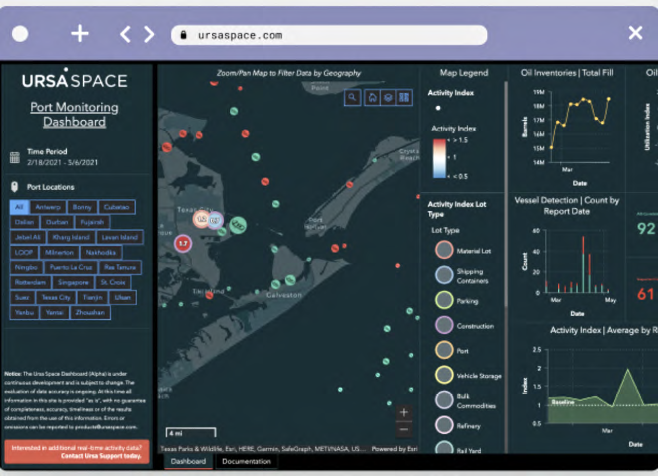
A company called Ursa Space wanted to find out. Ursa builds data systems that automatically analyze radar images that are captured by satellite. By automating the process, Ursa can analyze thousands of images taken over months and years.
 The Ursa Space analysis revealed an invisible navy in ports across China’s southwest coast.
That particular specialty was a perfect match for the problem. The South China Sea is hidden by clouds for half of the year. Radar ignores both clouds and darkness, and easily detects the steel hulls of fishing boats.
More than 150 fishing boats would form up into armadas in port and set sail together.
Ursa tracked their voyages to the Sea’s disputed zones—even when the ships turned off their legally-required radio trackers. In fact, ships without tracking signals were easier to identify as members of the Maritime Militia.
A report from the Center for Strategic & International Studies revealed that the Chinese government was paying the Militia to cover their operating costs. Rather than being humble fishermen fired by zeal for their country, the captains seemed to be on the government payroll.
China is hardly the first nation to claim territory beyond its borders. Its Asian neighbors have claims of their own.
 And there’s a reason why the western Pacific between Hawaii and the Philippines was known as “America’s Lake.”
But satellite technology and companies such as Ursa Space ensure that countries trying to win wars without fighting can no longer do it out of view of the world.
Produced by Space & Satellite Professionals International. See more stories and videos of satellite making a better world at www.bettersatelliteworld.com